Historical Gympie
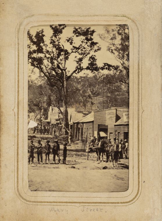
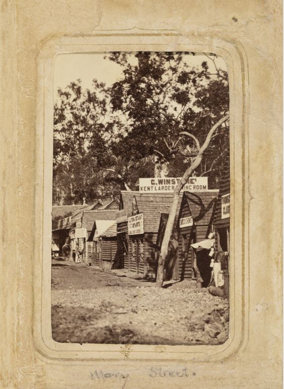
Gympie in 1867-68. Originally called Nashville, this is what is now Mary Street


Gympie Goldfield Album 1867-1868, Muller, Heinrich
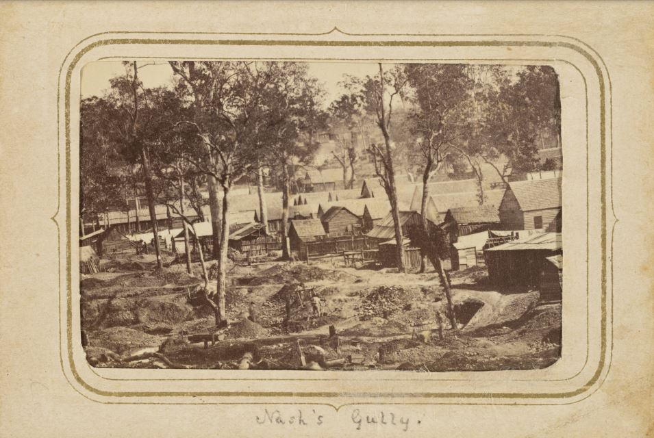
Abstract : Album (12 cm x 9 cm) containing ten original photographs depicting the Gympie (Nashville) goldfield. Two of the photographs are captioned in pencil on the back: “Mary Street, Nashville”. Nine of the photographs depict Mary Street and one depicts Nash’s Gully (where the gold was first discovered).
Description : Two of the photographs are stamped on the back: “Henry Muller, Photographic Artist, Ruthven Street, (Opposite the School of Arts), Toowoomba” and in manuscript “& Gympie”. In October 1867 James Nash discovered gold in a dry river bed at Gympie, and a dramatic gold rush commenced. The place of the find was called Nash’s Gully (near the site of the present Town Hall) and Gympie was first called Nashville. In 1868 the name was changed to Gympie, an Aboriginal term for local trees. This spectacular find was credited with saving the Queensland Government from bankruptcy.
Link : (original source : 29467, Gympie Goldfield Album, John Oxley Library, State Library of Queensland.)
Queensland State Archives _ Gympie goldfields postcards, 1870s – 1890s


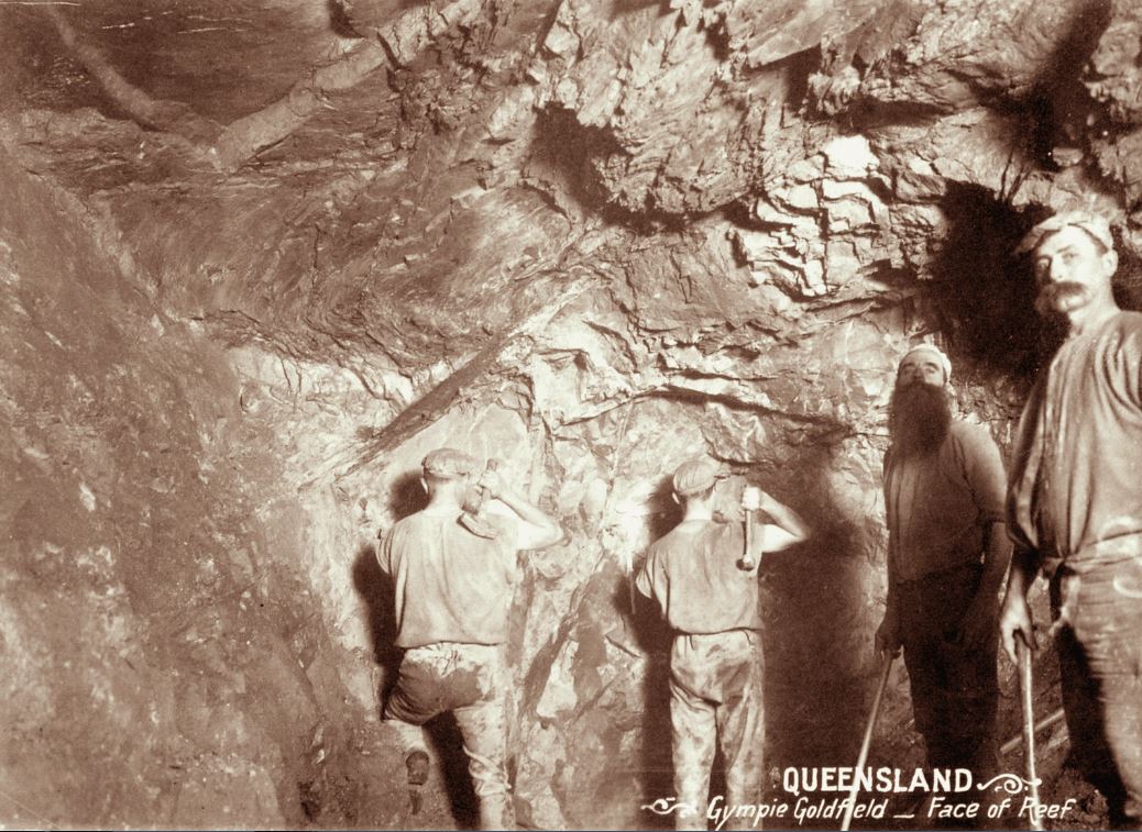
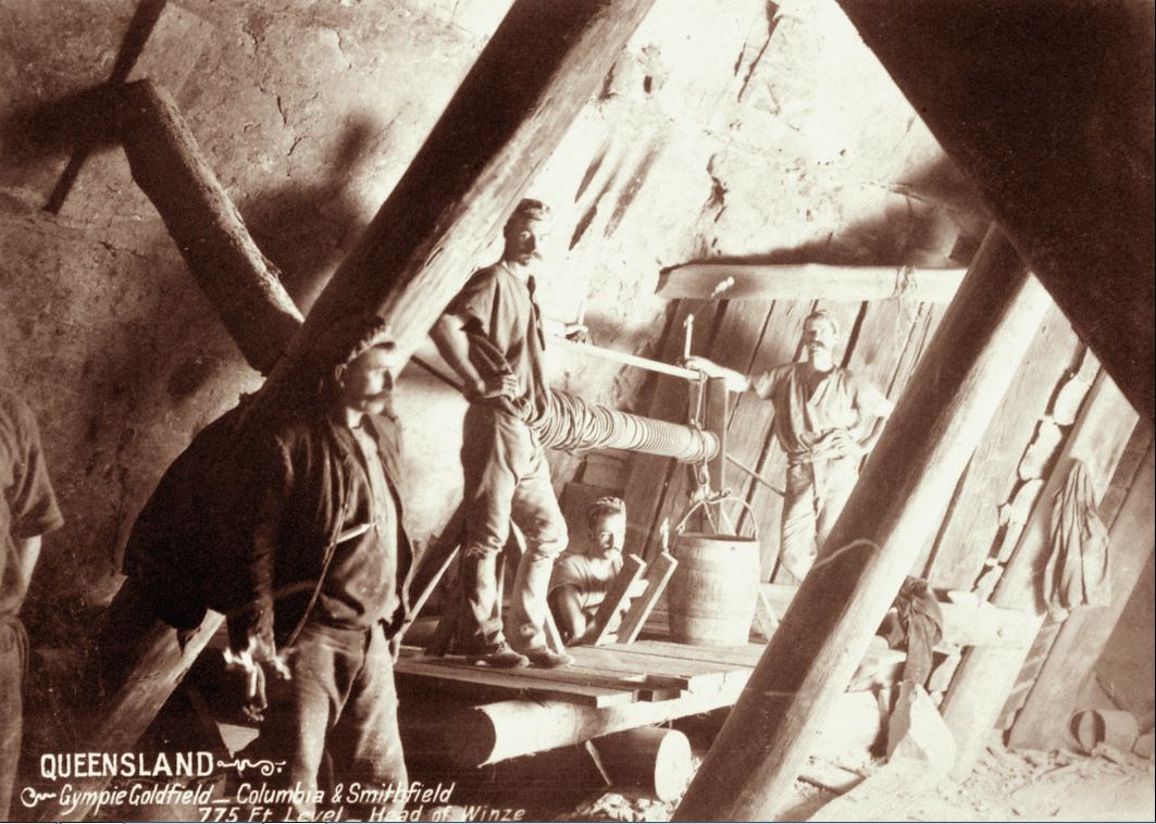
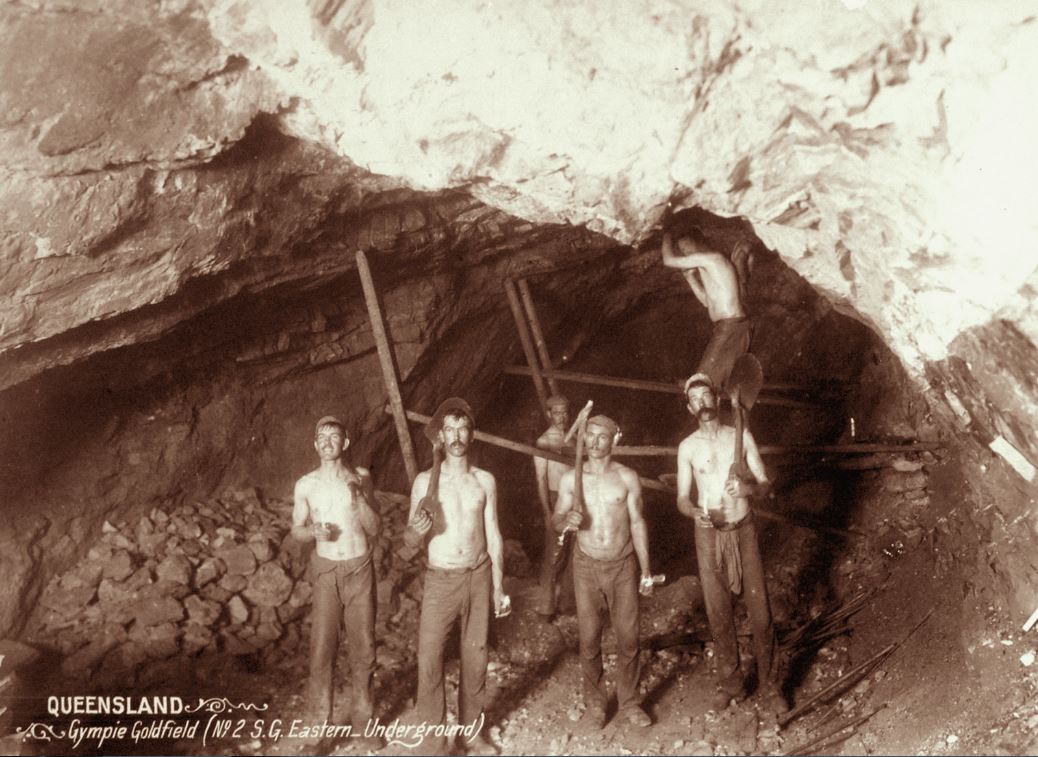


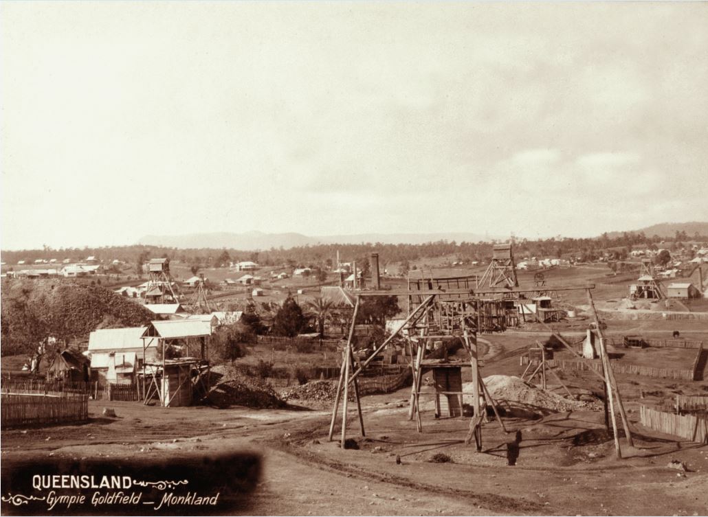


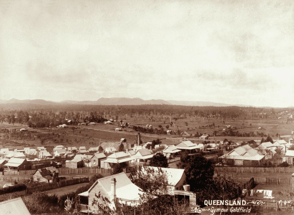


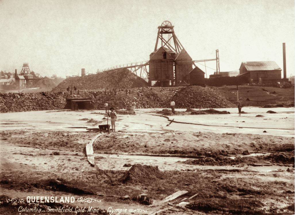
Here is an number of images sourced from the Queensland State Archives, now on Flickr, regarding the Gympie Gold fields area from 1870’s through to the 1890’s, from part of a postcard set.
Subjects : Photographic material; Black and white prints (photographs); Gympie Region
Description : These early images of Queensland were produced from glass plate and collodion (wet plate) negatives, now held by Queensland State Archives (SRS173). Around 1980, the Mapping and Surveying Department, a successor agency of the Lands Department, reproduced acetate positives (SRS167) and negatives from the original glass plate negatives. QSA currently only holds the positives. At about the same time, the Photography Centre created an index to the collection (SRS90).
This collection is generally known as the SUNMAP Historical Photograph Collection and includes images of land development, mines, urbanisation, dairy farms, vegetable cultivation, and orchards and vineyards at Beerwah, Crohamhurst, Maleny, Tentoberg, Esk, Gatton and Marburg. There are also images of wool stations at Yangan, Roma, Emu Vale, and Wallumbilla, the Brilliant St George Mine, scenes of Ipswich, Stanthorpe and Warwick, and images of Brisbane landmarks. There are also some images of the Torres Strait Islands and the Islanders.
Disclaimer: The information/text material found within is posted with good conscience and thought to be true and correct, but we do not guarantee the information/text material and must be viewed in a similar way as other information on the internet. Our Society website is maintained by our members who volunteer their time and skills.
Gympie Family History Society Inc.
Phone: 07 5482 8211
LOCATION
1 Chapple Street, Gympie Qld 4570
SECRETARY
gympiefamilyhistory@gmail.com
RESEARCH OFFICER
research@gfhs.com.au
Centre Opening Hours
Wednesday: 9:30am – 2:00pm
Friday: 9:30am – 12:00pm
Saturday: 1:00pm – 4:00pm


HOW TO FIND US
Located in the Old Ticket Office, under the Rattler Railway Station, cnr Station Road & Chapple Street, Gympie